Fort Osterburken - Frontiers of the Roman Empire
Osterburken, Germany
06.04.2017
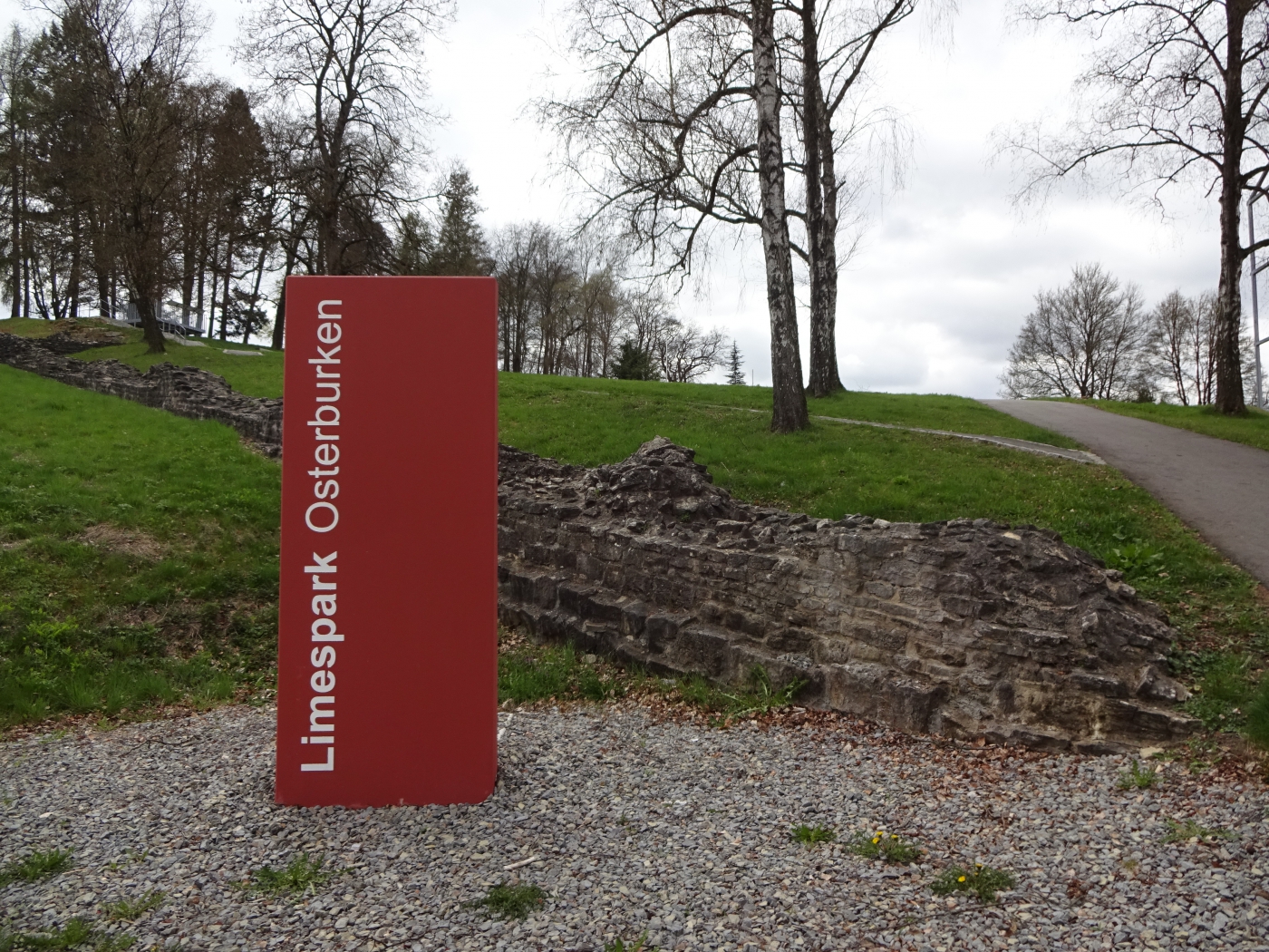
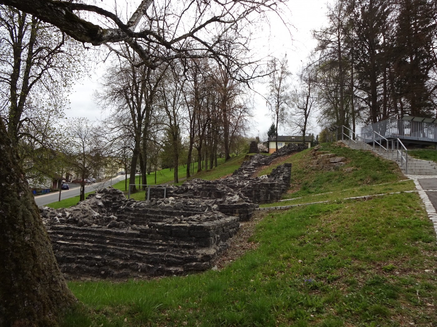
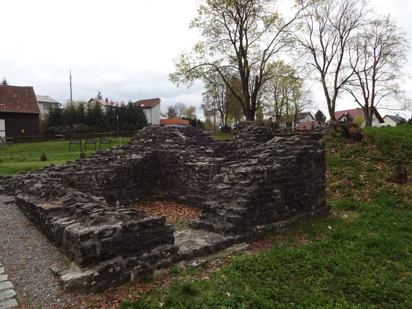
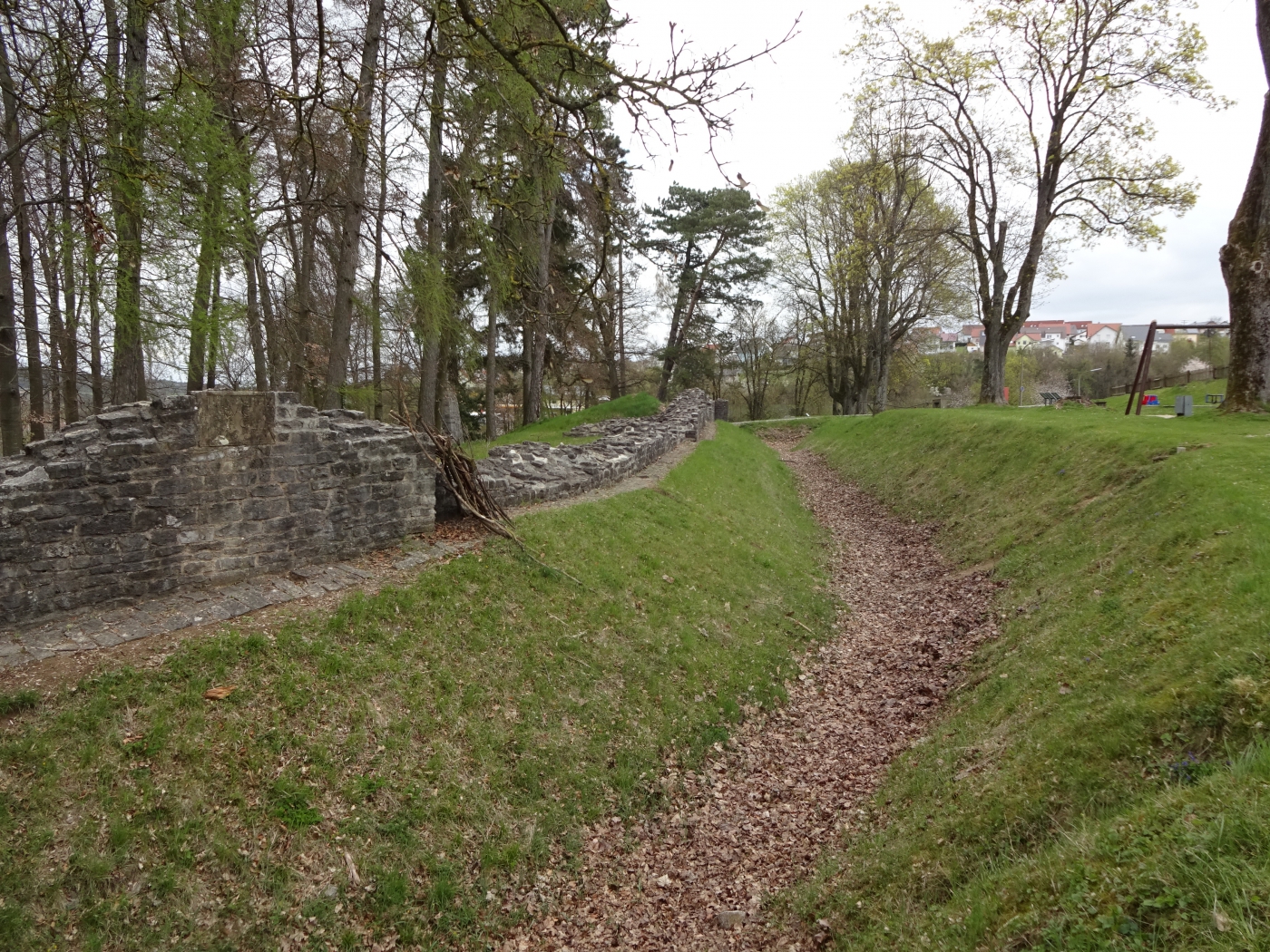
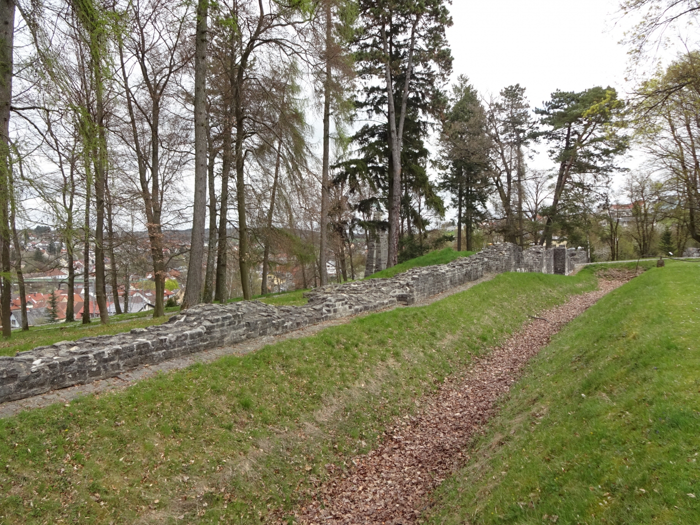
Kastell Osterburken is a UNESCO World Heritage Site located in the town of Osterburken, Germany. The site consists of the remains of a Roman fortification, which was built in the 1st century AD during the reign of Emperor Augustus. It was part of the Limes Germanicus, a defensive line of fortifications that stretched along the northern frontier of the Roman Empire.
The fortification was strategically located at the crossroads of two major Roman roads, the Römische Straße (Roman Road) and the Neckar-Odenwald-Limes (Neckar-Odenwald Limes). This allowed the Romans to control and protect the surrounding areas and trade routes.
The fort was originally built as a Cohort Castellum (fort for one cohort, around 500 soldiers), but was later expanded and became a Ala Castellum (fort for a cavalry unit, around 1000 soldiers). It was also used as a base for the Ala II Flavia milliaria (2nd Flavian Wing, 1000 strong) and the Cohors III Breucorum equitata (3rd Cohort of Breuci with cavalry support).
The remains of the Kastell Osterburken include parts of the fort's walls, gates, towers, and barracks. The Principia (headquarters) and the Praetorium (commander's residence) were also discovered during excavations. The fort was abandoned in the 3rd century AD, and the site was later used for farming and other purposes.
Today, visitors can explore the ruins of the Kastell Osterburken and learn about the daily life of Roman soldiers through reconstructed buildings and exhibitions. The site also offers guided tours and educational programs for schools.
Osterburken, the town where the fort is located, has a rich history dating back to the Celtic and Roman times. In the Middle Ages, it became an important trading center and a member of the Hanseatic League. The town was heavily damaged during World War II, but many of its historic buildings have been restored.
Visitors can also visit the Archaeological Museum Osterburken, which showcases artifacts and information about the history and culture of the region from the prehistoric times to the Middle Ages.
Further Links:
The ‘Roman Limes’ represents the border line of the Roman Empire at its greatest extent in the 2nd century AD. It stretched over 5,000 km from the Atlantic coast of northern Britain, through Europe to the Black Sea, and from there to the Red Sea and across North Africa to the Atlantic coast. The remains of the Limes today consist of vestiges of built walls, ditches, forts, fortresses, watchtowers and civilian settlements. Certain elements of the line have been excavated, some reconstructed and a few destroyed. The two sections of the Limes in Germany cover a length of 550 km from the north-west of the country to the Danube in the south-east. The 118-km-long Hadrian’s Wall (UK) was built on the orders of the Emperor Hadrian c. AD 122 at the northernmost limits of the Roman province of Britannia. It is a striking example of the organization of a military zone and illustrates the defensive techniques and geopolitical strategies of ancient Rome. The Antonine Wall, a 60-km long fortification in Scotland was started by Emperor Antonius Pius in 142 AD as a defense against the “barbarians” of the north. It constitutes the northwestern-most portion of the Roman Limes.
The Upper Germanic-Rhaetian Limes (German: Obergermanisch-Raetischer Limes), or ORL, is a 550-kilometre-long section of the former external frontier of the Roman Empire between the rivers Rhine and Danube. It runs from Rheinbrohl to Eining on the Danube. The Upper Germanic-Rhaetian Limes is an archaeological site and, since 2005, a UNESCO World Heritage Site. Together with the Lower Germanic Limes it forms part of the Limes Germanicus.
The Limes used either a natural boundary such as a river or typically an earth bank and ditch with a wooden palisade and watchtowers at intervals. A system of linked forts was built behind the Limes.
