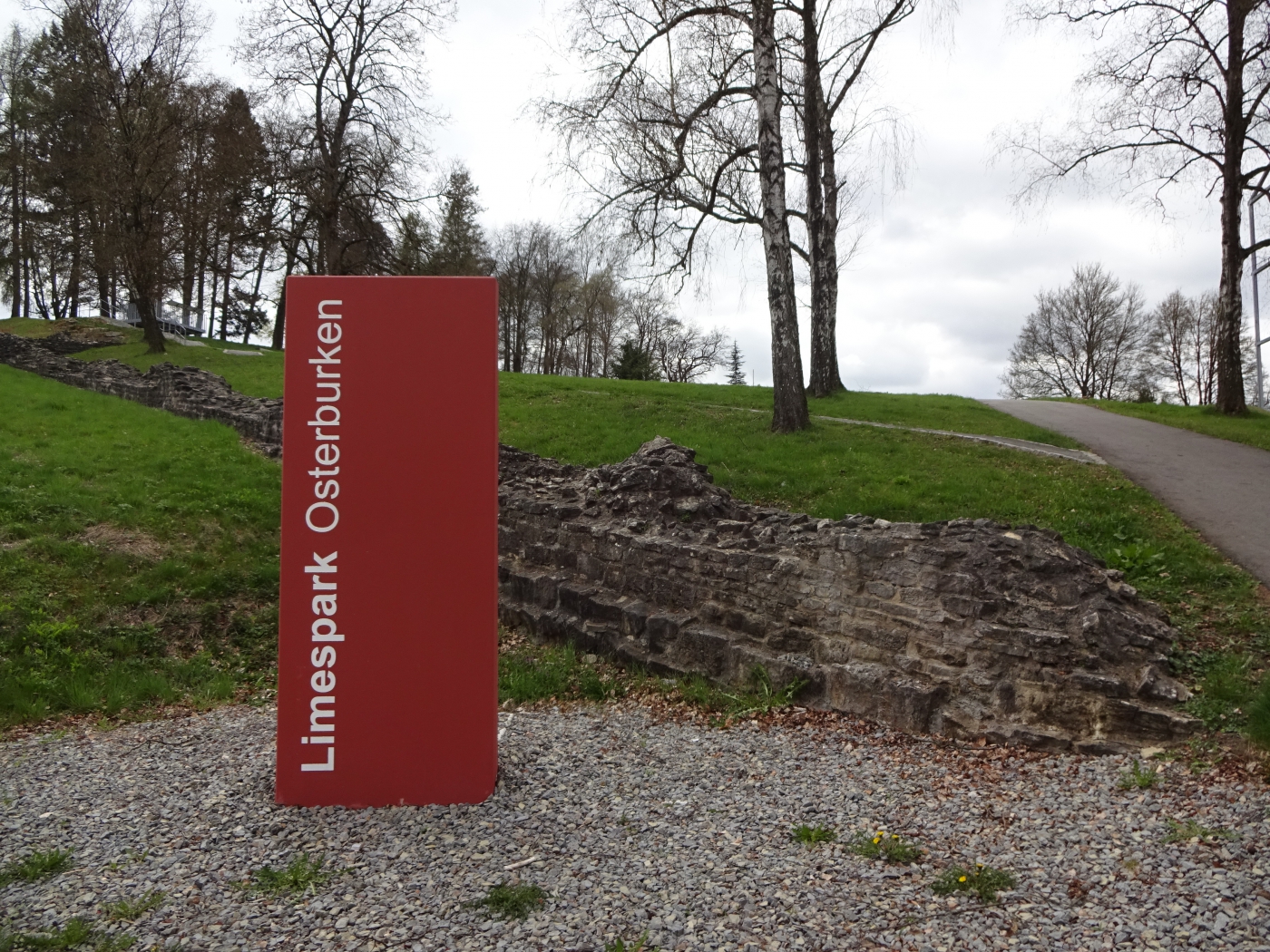
Fort Osterburken - Frontiers of the Roman Empire
Osterburken, Germany
06.04.2017

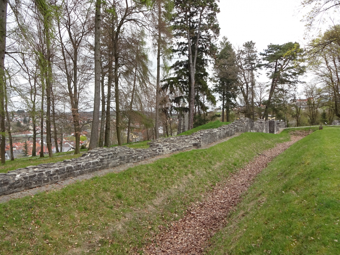
The Kastell Osterburken, located in the town of Osterburken in Germany, stands as a pivotal testament to the vast reach and sophisticated frontier defenses of the Roman Empire. As a crucial component of the Upper Germanic-Rhaetian Limes, it is inscribed on the UNESCO World Heritage List, safeguarding the legacy of what was once the largest archaeological monument in Central Europe. This former Roman fort offers a profound glimpse into daily life, military organization, and the strategic complexities along the Roman frontier.
A Strategic Frontier Post
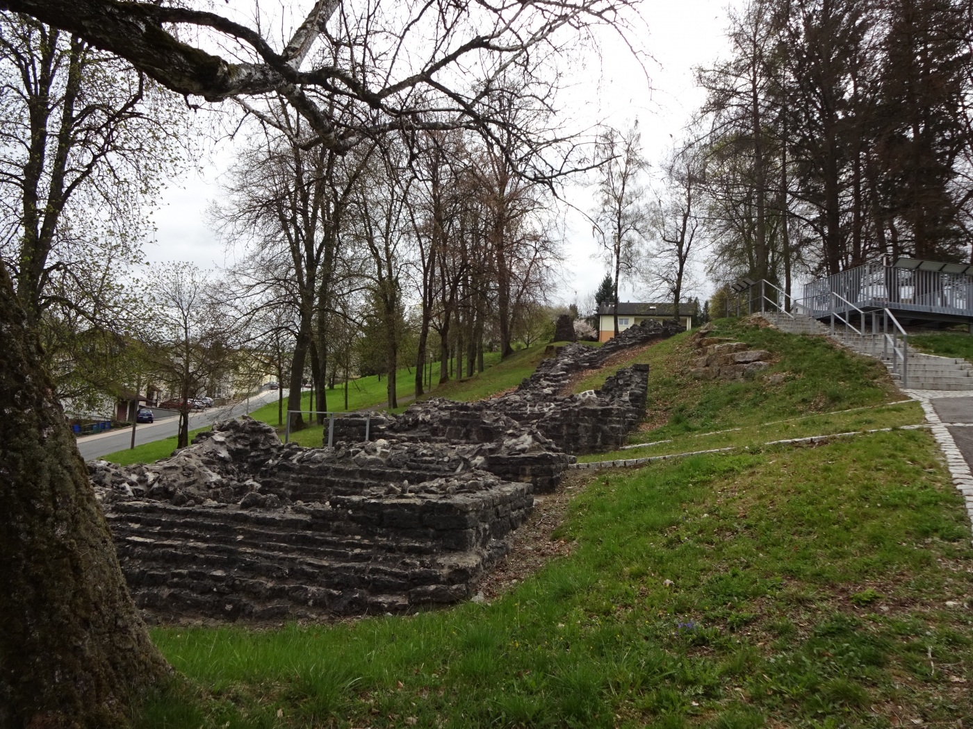
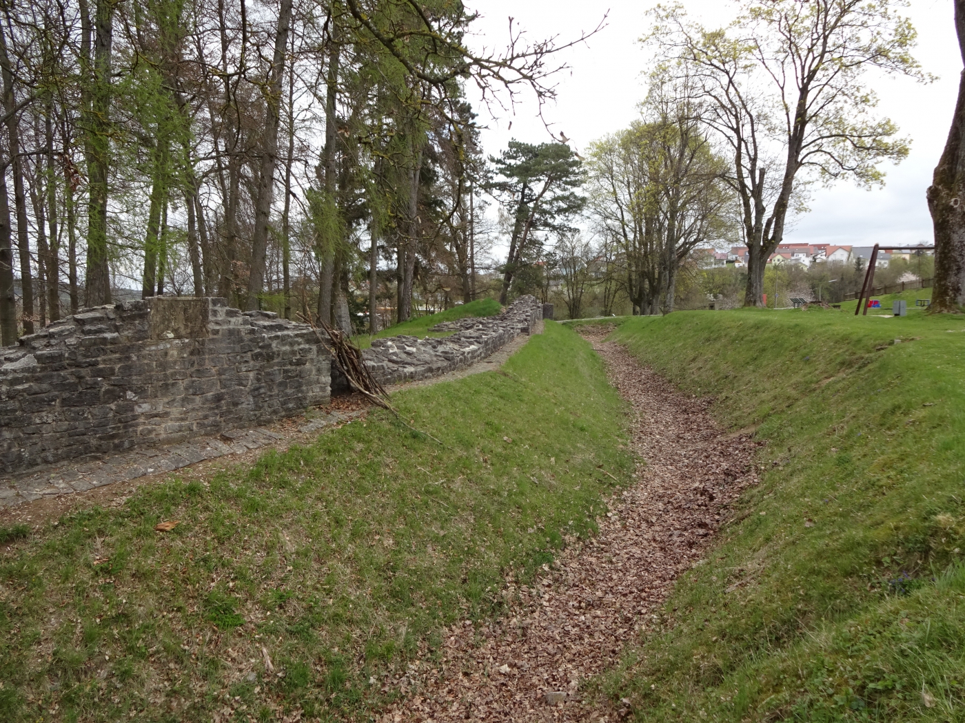
Constructed around 100 AD, Kastell Osterburken was strategically positioned to guard a significant section of the Limes, the impressive fortified border that stretched for hundreds of kilometers. Initially, it was a smaller earth-and-wood fort, but it underwent several phases of expansion and reconstruction. By the mid-2nd century, it had been rebuilt in stone, becoming a robust and permanent installation. It housed a cohort of around 500 auxiliary soldiers, likely the Cohors III Dalmatarum equitata, a mixed unit of infantry and cavalry from Dalmatia, whose task was to patrol and secure the frontier against incursions from Germanic tribes.
Life at the Limes
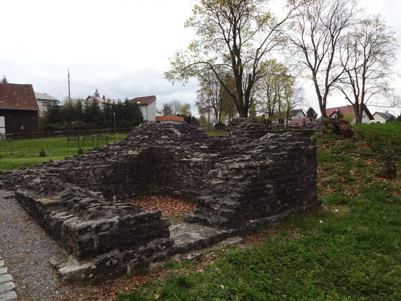
Life at Osterburken was a blend of military discipline and civilian interaction. Outside the fort walls, a bustling vicus – a civilian settlement – developed, providing services and amenities for the soldiers and their families. This community included traders, artisans, and other settlers, illustrating the symbiotic relationship between the military presence and economic development along the Limes. Archaeological excavations have uncovered remains of barracks, commanders' quarters (the principia), granaries (horrea), and bathhouses, all essential elements of a Roman fort. The bathhouse, in particular, was a significant feature, not only for hygiene but also as a social hub for the soldiers.
The End of an Era and Rediscovery
The fort was eventually abandoned around 260 AD during the period of the Alemannic Invasions, as the Romans withdrew their frontier to the Rhine and Danube rivers. For centuries, the ruins lay buried, slowly reclaimed by nature, until systematic archaeological work began to uncover its secrets. Today, visitors can explore the reconstructed sections of the fort and the excellent RömerMuseum Osterburken, which houses a wealth of artifacts, including pottery, tools, weapons, and religious altars, providing tangible connections to the soldiers and civilians who once lived here. The museum vividly reconstructs life on the Limes and highlights the fort's role within the larger World Heritage site, making the history palpable for modern audiences.
Further Links
The ‘Roman Limes’ represents the border line of the Roman Empire at its greatest extent in the 2nd century AD. It stretched over 5,000 km from the Atlantic coast of northern Britain, through Europe to the Black Sea, and from there to the Red Sea and across North Africa to the Atlantic coast. The remains of the Limes today consist of vestiges of built walls, ditches, forts, fortresses, watchtowers and civilian settlements. Certain elements of the line have been excavated, some reconstructed and a few destroyed. The two sections of the Limes in Germany cover a length of 550 km from the north-west of the country to the Danube in the south-east. The 118-km-long Hadrian’s Wall (UK) was built on the orders of the Emperor Hadrian c. AD 122 at the northernmost limits of the Roman province of Britannia. It is a striking example of the organization of a military zone and illustrates the defensive techniques and geopolitical strategies of ancient Rome. The Antonine Wall, a 60-km long fortification in Scotland was started by Emperor Antonius Pius in 142 AD as a defense against the “barbarians” of the north. It constitutes the northwestern-most portion of the Roman Limes.
The Upper Germanic-Rhaetian Limes (German: Obergermanisch-Raetischer Limes), or ORL, is a 550-kilometre-long section of the former external frontier of the Roman Empire between the rivers Rhine and Danube. It runs from Rheinbrohl to Eining on the Danube. The Upper Germanic-Rhaetian Limes is an archaeological site and, since 2005, a UNESCO World Heritage Site. Together with the Lower Germanic Limes it forms part of the Limes Germanicus.
The Limes used either a natural boundary such as a river or typically an earth bank and ditch with a wooden palisade and watchtowers at intervals. A system of linked forts was built behind the Limes.